The summer season is in full swing with long days, golden hillsides and sun-painted skies. While it’s an excellent time to get out and explore your local open space preserves, remember to prioritize safety.
Summer heat can be deceiving, so plan your hike for cooler mornings or evenings. It's crucial to bring plenty of water – a good rule of thumb is to carry at least a liter for every two hours of hiking, and adjust based on the intensity and temperature.
Sun protection is another must-have. Lather up with sunscreen and reapply every two hours, especially after sweating. A wide-brimmed hat and sunglasses further shield you from the sun's harsh rays, keeping you comfortable and allowing you to fully enjoy the breathtaking views. Check out more tips.
Identifying and visiting trails with shade cover is an excellent way to explore nature while staying cool. Using Midpen’s Trail Explorer web tool, you can plan your next summer outing to a Midpen preserve by filtering for shaded trails. Here are five shaded trail recommendations:
")
Oljon Trail (among many others) – El Corte de Madera Creek Open Space Preserve
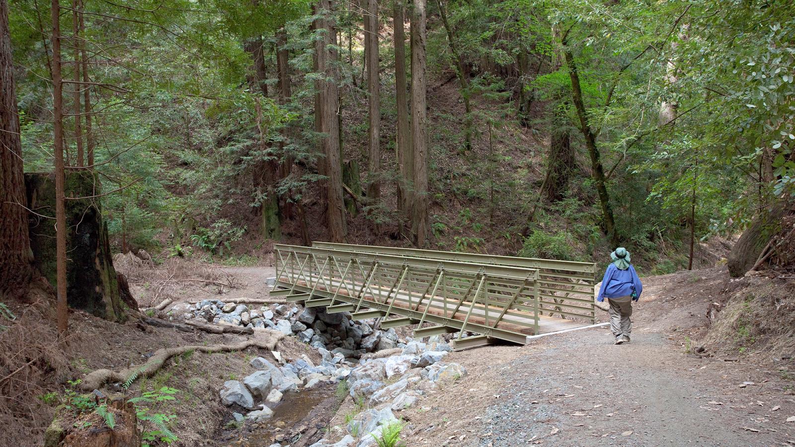
The El Corte de Madera Creek area, meaning "cut wood" in Spanish, had up to 15 sawmills during the late 1800s. Numerous logging roads have been converted into trails and the landscapes the deep canyons have regenerated dense stands of second-growth redwoods. Most of the trails in this preserve are protected from direct sunlight.
Funded by Measure AA, the Oljon Trail opened in 2019 as the newest addition to this preserve and as a new segment of the Bay Area Ridge Trail. Visitors can travel along a single-track trail, winding along a redwood-forested ridgeline on the western slope of the Santa Cruz Mountains. You can see sandstone outcroppings as well as many old-growth stumps from early logging, with springboard notches still visible in some of them.

Franciscan and Lost Creek Loop Trails – Los Trancos Open Space Preserve
This route combines two scenic loops, the Franciscan Loop Trail and the Lost Creek Loop Trail, to explore this small, wedge-shaped preserve that is rich in geological and botanical interest. The San Andreas fault runs through the preserve-check out the self-guided interpretive tour of the nearby San Andreas Fault Trail.
Oaks, bays, bigleaf maples and Douglas firs provide a protective canopy for an assortment of native shrubs. Along the way, visitors descend to the headwaters of Los Trancos Creek, which forms part of the border between San Mateo and Santa Clara counties.

Stevens Creek Nature Trail/White Oak Loop – Monte Bello Open Space Preserve
The first segment, from the Monte Bello Parking Area to the vista point, is an easy-access portion that can accommodate a wide array of physical abilities. At an average grade of 5%, this gently sloping segment takes visitors to a dramatic vista point and to a bench where visitors can sit and look down Stevens Creek Canyon to see the peaks of Mt. Umunhum and Loma Prieta.
From the bench, the trail descends 450 feet into a forested canyon to Stevens Creek itself, and then continues along the creek before turning right and climbing back up the White Oak Trail and back to the parking area. Please note, this 3.2-mile loop includes an uphill climb back to the parking area regardless of which way you start your hike. Additionally, the beginning and end segments of the trail provide little to no shade cover.

Peters Creek to Long Ridge Trail Loop – Long Ridge Open Space Preserve
The Peters Creek Trail is an out-and-back singletrack trail that wanders across a hillside and down into a shaded woodland filled with coast live oak, canyon oak and madrone trees. Next, the trail descends into a forest of mostly Douglas fir and California bay trees that tower over an understory of toyon, blue elderberry, hazelnut, buckbrush, snowberry, ferns and berry vines.
To create a loop, follow the Peters Creek trail for about a mile, then turn sharply right onto Long Ridge Trail. Follow Long Ridge Trail for just over one mile, and link back with the Peters Creek Trail to loop back to the parking area. This loop route totals just under 2.5 miles.
Saratoga Gap Trail – Saratoga Gap Open Space Preserve
This out-and-back route, heavily used by bicyclists, also delights hikers and equestrians. Although never far from busy Skyline Boulevard, the trail provides a remarkable feeling of seclusion as the route drops into a mixed evergreen forest with massive Douglas firs and a few California nutmeg trees, an evergreen that is uncommon on Midpen lands.
Soon, the trail begins climbing on a gentle grade under the outstretched limbs of a large canyon oak, and then switchbacks up a grassy slope. Next, the rocky trail descends past stands of tanoaks and California bay trees where thimbleberry, snowberry, hazelnut, oceanspray, poison oak, ferns and berry vines form the forest understory