Overview
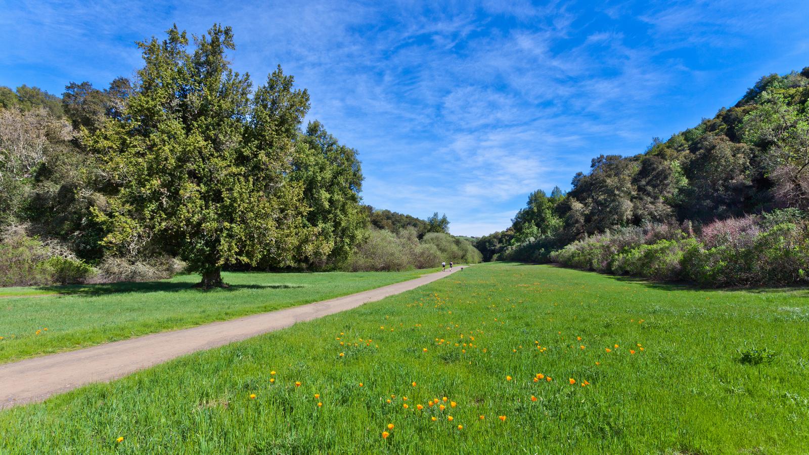
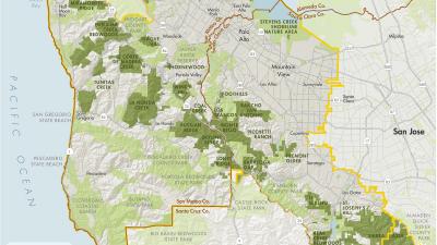
Rancho San Antonio County Park & Open Space Preserve offers visitors a unique experience with a sampling of diverse environments, interesting cultural history and a variety of activities. The area features over 25 miles of trail throughout the 2,180-acre open space preserve and adjoining 293-acre county park.
Rancho San Antonio County Park is managed by Midpen through an operations and management agreement with the Santa Clara County Parks and Recreation Department.
Stretching bars are available at the restroom parking area and equestrian staging area. The park provides hiking, bicycling and equestrian trails, which connect with additional trails within the open space preserve. Bicycles are restricted to designated trails only, and are not permitted west of Deer Hollow Farm. Equestrians are limited to the equestrian staging area and Coyote Trail, within the county park.
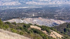
This four-mile trail climbs through chaparral, grassland, and oak woodland to the top of Black Mountain, connecting with Monte Bello Preserve. From the top of the 2,800-foot Black Mountain, there are views west into Stevens Creek Canyon, the open space lands along Skyline Ridge and across Santa Clara Valley.
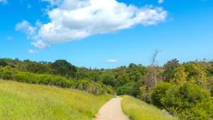
This 2.1-mile trail ascends gradually to a tranquil, secluded meadow in the northern part of the preserve. This spot — which adjoins Hidden Villa Ranch, a non-profit environmental education facility — was once the location of a picturesque windmill from former ranch days when cattle freely roamed the hillsides. It's the perfect spot for a picnic amid fields of grass in the shadow of Monte Bello Ridge and Black Mountain.
This trail provides challenging 3.7-mile hike with a 1,600-foot elevation gain, following the path of electrical towers up Black Mountain. Hikers are rewarded with great views of the Bay Area and the western foothills. Combine with Wildcat Canyon or Upper High Meadow Trails for a longer loop.
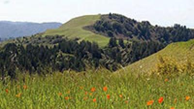
A popular route for hikers and joggers, this this three-mile loop trail follows a creek into a cool, fern-walled narrow canyon, ascends through chaparral to open meadows on the middle ridge, and loops back to Deer Hollow Farm. Lupine, poppies, and patches of blue-eyed grass bloom in the meadows in spring. Visitors can pause or picnic here and, on a clear day, enjoy spectacular views of Mount Tamalpais to the north and Mount Hamilton to the east.
Preserve Highlights & Features
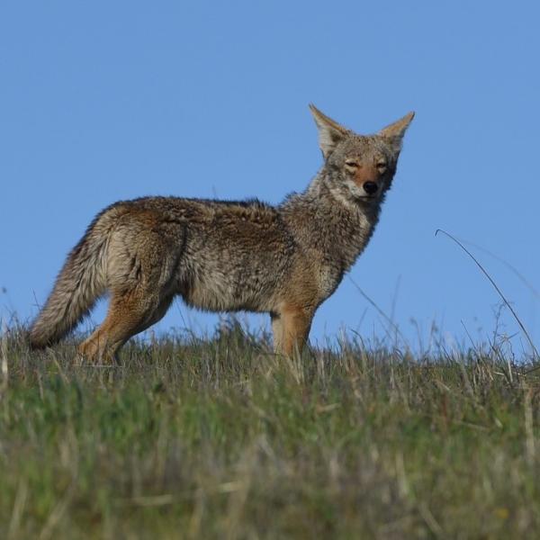
Coyotes
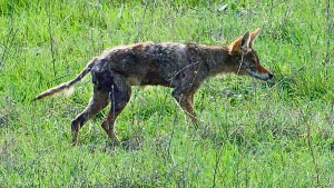
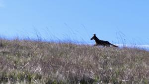
Coyotes have been recently observed in this preserve. Coyotes are a natural part of this region’s ecosystem. They are extremely adaptable omnivores that hunt small animals such as brush rabbits, squirrels and gophers and will also scavenge carcasses.
How to behave around coyotes
- Never feed coyotes
- Do not leave children unattended
- Coyotes may be aggressive around pets during the spring-early summer denning season
If you encounter an aggressive coyote, take these safety precautions
- Make loud noises
- Keep children and pets close
- Do not approach the coyote
- Do not turn your back on the coyote
- Do not crouch down or bend over
- Back away slowly and leave the area, giving the coyote an opportunity to escape
- Fight back if attacked
- Report aggressive behavior, threats and attacks immediately to District Ranger Dispatch (650)-968-4411
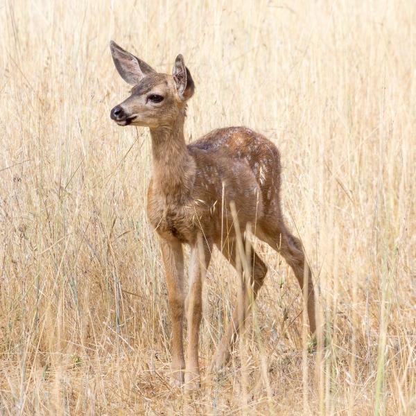
Wildlife
Wildlife abounds at Rancho San Antonio Preserve. Visitors may see deer grazing in the meadow and flocks of wild turkeys along the trail. Raptors soar overhead and the preserve's many trees provide habitat for a variety of birds.
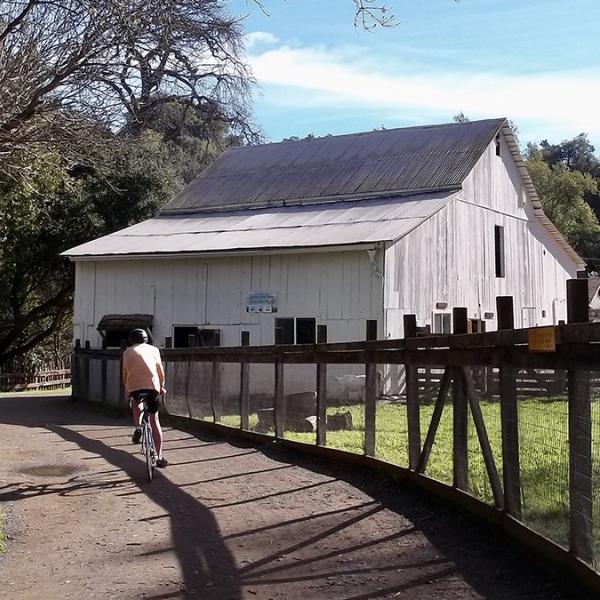
Deer Hollow Farm
A highlight of the preserve is Deer Hollow Farm, a working farm with turn-of-the-century ranch buildings, an organic garden and a cow, pigs, goats, sheep, chickens and other animals. An additional attraction is the restored Grant Cabin, furnished to represent living conditions in the late 1800s.
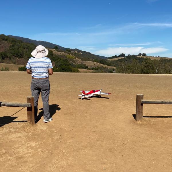
Model Airplane Field
Model airplane enthusiasts use a staging area adjacent to the parking lots near the park entrance for takeoffs and landings and fly their aircraft above the South Meadow area.
Download model airplane rules here. Please note that during red flag warnings the model aircraft area will be closed.
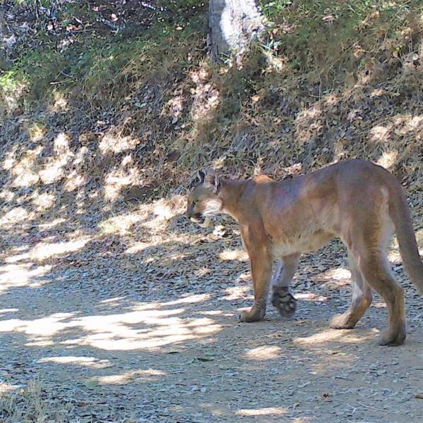
Mountain Lions
If you see a mountain lion do not run; slowly back away, leave the area and report the sighting to a Midpen ranger at 650-691-2165.
Mountain lions in California face many challenges. They need large habitats, and because their native territories in the Santa Cruz Mountains have become hemmed in by roads and development, some mountain lions inhabit areas of open space near the wildland-urban interface. As a top-level predator, mountain lions play an important role our local ecosystem and projects like the Midpen Highway 17 Wildlife and Trail Crossings are critical to keeping wildlife populations safe and healthy.
Stories from the Preserves
Nature
Here are some of the plants and animals that other visitors have observed at this preserve and recorded in iNaturalist. Protected species may be excluded and some species may not yet have been observed. Help improve iNaturalist by adding your observations to the Midpen Biodiversity Index project.
Join our e-mail list to stay up-to-date on this preserve and other Midpen news!
Know Before You Go
Preserve regulations help provide a safe, enjoyable visit while protecting sensitive areas and wildlife.
Share the Trail
Use designated trails to avoid damage to natural resources and prevent injury.
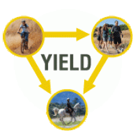
Avoid blocking the trail. Step aside to allow others to pass .
Whether you’re walking or biking, always yield to equestrians.
Leave no trace. Pack out what you pack in. Most preserves do not have trash cans. Littering is prohibited.
Abuses of trail etiquette should be brought to the attention of a ranger or call the Midpen main office at 650-691-1200.
Parking Lot 6 Restroom Closure
Beginning Monday, February 2nd, construction will start on the restrooms in Lot 6 to complete ADA and fixture upgrades. A small section of the parking lot will also be closed during this time. Construction is expected to continue through the end of March. Portable restrooms will be provided.
The following trails may be closed to equestrian use during wet conditions.
- Hammond-Snyder Loop Trail is CLOSED to equestrians.
- Quarry Trail is CLOSED to equestrians.
Parking at the preserve can be congested at busy times. Bicycling, walking, use of ride apps or public transportation are encouraged.
Bike to Rancho!
When you ride your bike to Rancho San Antonio you can use a bicycle-friendly route away from the main entrance and park at one of the many bicycle racks we have installed at multiple trailheads throughout the preserve. Download a map highlighting our bicycle-friendly entrance and bicycle rack locations, or use this link to map a route to our bicycle friendly entrance.
Silicon Valley Hopper
Leave your car behind and take Silicon Valley Hopper (formerly Via-Cupertino), an on-demand shared ride service providing transportation to and from Rancho San Antonio from anywhere in Cupertino, Southern Santa Clara, and the Mountain View, Sunnyvale, and Santa Clara Caltrain stations.
Real-time parking availability
There is a physical electronic signboard displaying real-time parking availability at the entrance gate.
You can also check the status online at openspace.org/rsa-parking before you leave home.
- Lot 1 (80 spaces + 4 ADA + 2 Equestrian): This lot is part of Rancho San Antonio County Park land.
- Lot 2 (48 spaces + 1 ADA): Located on Rancho San Antonio County Park land
- Lot 3 (22 spaces + 2 ADA): Located on Rancho San Antonio County Park land
- Lot 4 (46 spaces + 2 ADA): Located on Rancho San Antonio County Park land
- Lot 5 (30 spaces): Located on Rancho San Antonio County Park land
- Lot 6 (83 spaces + 5 ADA): Located on Rancho San Antonio County Park land
- Rhus Ridge Parking Area (9 spaces + 1 ADA): Located on the north end of Rancho San Antonio Open Space Preserve.
Driving directions From I-280 (north or south):
- Take the Foothill Boulevard exit and proceed south on Foothill Boulevard approximately 0.2-mile to Cristo Rey Drive.
- Turn right on Cristo Rey Drive, continue for about 1
- mile, veer right around the traffic circle, and turn left into the County Park entrance.
- There are several parking lots, including one designated for equestrian trailers. The trailhead for the preserve is located adjacent to the 85-car parking area in the northwest lot.
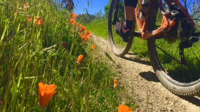
- Bicyclists: Bicycles are allowed on designated trails only (marked on map). Helmets are required. Observe the 15 mph trail speed limit (5 mph when passing). Class 1 and Class 2 e-bikes are allowed on limited improved trails in this preserve. Avoid startling hikers and equestrians by announcing your presence when approaching from behind. Please consult preserve maps for trail information. For more information visit the Bicycle Access page.
- Dogs: Dogs are not allowed in this Preserve. For information on dog-friendly preserves visit the Dog Access page. In accordance with the Americans with Disabilities Act, Midpen accommodates service dogs in preserves wherever we allow public access.
- Drones and Model Aircraft: Model Airplanes are allowed in designated area of Rancho San Antonio County Park ONLY. Gas-powered models, model rockets and drones are not allowed. Model Aircraft Rules
- Equestrians: Horses are allowed on designated trails (marked on map). Helmets are recommended for all equestrians. For more information visit the Equestrian Access page.
- Fires are prohibited in preserves.
- Plants & Wildlife: Please leave undisturbed. If you encounter wildlife during a visit, do not approach, startle or feed it. Although wild animals are generally fearful of humans and will run away, some wildlife can be dangerous.
- Smoking is prohibited in preserves.
- Water Areas: Swimming, wading or engaging in any water-contact activity is prohibited.
- Weapons are prohibited in preserves.
A general access permit is required for any activity or event that:
- may be attended by twenty (20) or more people; OR
- would restrict the use of any part of Midpen lands by members of the public; OR
- requests or requires a fee be paid or a donation made for participation. This includes events where the fee is in the form of a mandatory purchase, such as a t-shirt.
Midpen trails and facilities are generally very safe. However, you are entering an environment where there are some naturally occurring hazards. Reasonable caution and common sense should be utilized when venturing into any outdoor environment.
- Do not leave valuables in your vehicle! Lock your vehicle and store valuables out of sight or take them with you on the trail.
- Travel in groups of two or more. Two of more people can assist each other in the event of an accident or emergency.
- Dress for the environment. Temperature changes can be occur and you should dress in layers appropriate for the location, time of year and planned activities.
- Carry water with you. Drinking water is not available at most Midpen preserves so you should bring your own. Two quarts per person per two hour hike is recommended.
- Apply sunscreen and drink plenty of water prior to and during your outdoor activities.
- Be aware that cell service is very sporadic on the preserves.
Be Prepared and Aware
Plan ahead before you leave. Check regulations and weather, download a map, pack water and first aid.
Know your limits and take safety precautions.
Rattlesnakes are native to this area and are especially active in warm weather.
Poison oak grows on most preserves: Learn to identify and avoid it in all seasons.
Ticks are present in this area and may carry diseases.
Mountain lions are a natural part of this region’s environment and are occasionally seen.
In Case of Emergency
If you experience an emergency (fire, accident or other immediate threat to life or property), call 911. For nonemergencies, call 650-691-1200.
Activities & Events
History
The Ohlone Indians lived in the Rancho San Antonio area for over 3,000 years prior to the arrival of the Europeans. A large village, known as Partacsi, was located in this general area. An expedition led by Colonel Juan Baptista de Anza passed through this area in March of 1776. Mission Santa Clara de Asis was founded in October of the same year. In 1822, Mexico became independent and the Secularization Act stripped the missions of their holdings. After 1833, land grants were mainly given to army veterans and many ranchos were established. The chief commercial products of the ranchos were cattle hides and tallow. Governor Alvarado granted Rancho San Antonio to Juan Prado Mesa in 1839. This 440-acre rancho was bounded by Adobe Creek to the north and Stevens Creek to the south, and included Permanente Creek. Mesa had been a soldier at the San Francisco Presidio since 1828, served as a corporal in the Santa Clara Guard. Mesa died in 1845. California became part of the United States in 1848 and all land grants issued by the Mexican government became subject to review under U.S. law.
In 1853, William Dana, a former seafarer and merchant, purchased the Rancho. During this time the original Mexican land grants were challenged and six persons laid claim to the Rancho. Two of the claims were patented by the United States in 1857, with Dana retaining 3,542 acres. In 1861, John and Martha Snyder purchased 850 acres of the original Rancho San Antonio lands on Permanente Creek. The Snyder's grain crop of 1862 was the first raised without irrigation in this area of the county and was so successful that it inspired others. The Snyder's had about 500 acres under cultivation, including a 16-acre vineyard with a large winery and 25 acres in orchard. John Snyder, born in 1828 in Indiana, arrived in Santa Clara County in 1850 where he was employed on local farms. In 1855, he married Martha Kifer. John died in 1901 and his wife continued to live on the ranch until her death in 1919.
In 1923, the Catholic Church purchased the Snyder Ranch and in 1926 constructed Saint Joseph's Seminary and the Maryknoll Seminary. St. Joseph's was badly damaged in the 1989 earthquake and was subsequently demolished. The Maryknoll Seminary, with its oriental motif, stands east of the park across Cristo Rey Drive. The Santa Clara County Parks Department purchased 130 acres in 1977 and another 35 acres in 1981 from St. Joseph's Seminary. The county park improvements were constructed in the early 1980s, with additional improvements completed in 1993.
Brochures and Resources
Some additional resources to help you enjoy the preserves!

